

FPV Drone
Speed and Style. Cinematic Results
Flight Like Never Before
Our FPV (First-Person View) drone service delivers dynamic, high-speed aerial footage that puts viewers right in the action. With agile, immersive camera work and cinematic motion, FPV is perfect for capturing energetic scenes, close-quarters movement, and jaw-dropping fly-throughs.. all filmed with precision by our skilled pilots.

Immersive Visuals

Agility & Precision

Dynamic Fly-Throughs

Creative Storytelling

High-Energy Cinematics

Compact & Versatile

CASE STUDY
Boots Store Opening - Cork
As a trusted partner, we align our expertise with your organizational goals, delivering tailored solutions that drive measurable outcomes and long-term success.
Immersive Storytelling & Visual Impact
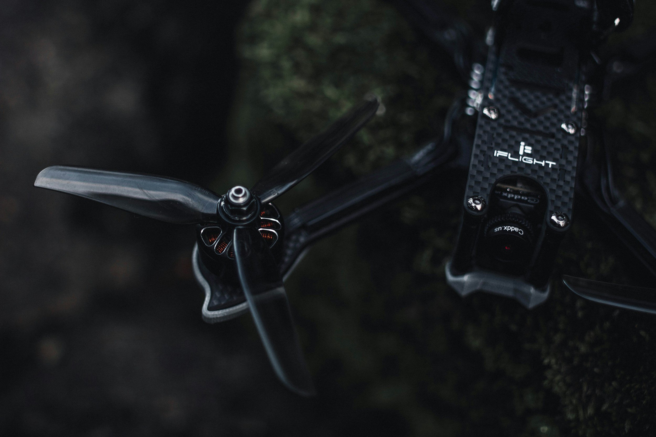
FPV drone footage delivers a bold, first-person view that places the audience directly into the action. With fluid, cinematic motion and unique flight paths, FPV creates a sense of presence that traditional drones can’t match.. perfect for brand videos, property tours, and high-impact marketing content that leaves a lasting impression.
Indoor Fly-Throughs & Tight Navigation
Our custom FPV drones are compact and agile, allowing us to fly through narrow corridors, doorways, and architectural features. This makes FPV the ideal choice for filming inside buildings, venues, showrooms, or busy environments where standard drones can’t operate.. all while maintaining smooth, professional-grade footage.
High-Energy Movement & Dynamic Angles
From racing over landscapes to following athletes at speed, FPV drones can perform fast, complex movements with ease. This makes them ideal for capturing action sports, car launches, event walkthroughs, or behind-the-scenes moments.. all filmed with a dramatic, energetic style that grabs attention and amplifies excitement.
Our Process
Working with Aerial is a seamless and professional experience from start to finish. We handle everything from planning and compliance to data capture and final delivery, ensuring a hassle-free process for our clients. Our team prioritizes efficiency, accuracy, and safety, so you get high-quality results without disrupting your operations. Below is a step-by-step breakdown of what you can expect when partnering with us.

We begin with a discussion to understand your project’s needs, scope, and objectives. A precise flight plan is designed to capture the required data efficiently. We coordinate with your team to schedule flights at the best times for minimal disruption.
1. Consultation & Planning

2. Aerial Capture
Using advanced drone technology, we capture high-resolution imagery, videos, or survey data. Our experienced pilots ensure accuracy and safety while keeping operations quick and efficient.

3. Post Processing
Collected data is processed using industry-leading software to generate maps, reports, and marketing visuals. We refine and format the outputs to ensure they’re clear, actionable, and ready for use.

4. Delivery
Final assets are delivered in your preferred format, with explanations or insights as needed. We remain available for any follow-up questions, future updates, or additional services.

Full Production Service
At Aerial, we provide a seamless, end-to-end production service, ensuring every project is expertly managed from concept to final delivery. Our team handles everything from planning and coordination to on-the-ground videography and dynamic aerial drone filming, capturing stunning visuals with precision and creativity.

Project Management

Videography

Film Crew

Drone Filming

Post Production
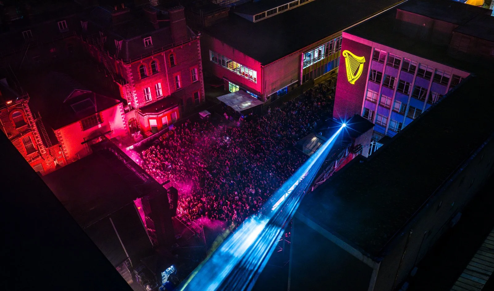
CASE STUDY
Guinness Storehouse
As a trusted partner, we align our expertise with your organizational goals, delivering tailored solutions that drive measurable outcomes and long-term success.
Safety First
A SORA license, issued by the European Union Aviation Safety Agency (EASA), is a safety approval for drone operations that don’t fit into the standard low-risk rules. It’s used for activities that might involve more complicated or higher-risk situations, like flying drones over people or in busy areas.
We also hold a license for the UK
The SORA license allows us to operate in areas and to limits that other drone operators can’t access.

1KM
HEIGHT
CITY CENTRE


DISTANCE
AIRPORTS

400FT
FAST PERMISSIONS
LARGE CROWDS


Request Our Brochure
