

INFRASTRUCTURE
Innovation That Moves, Imagery That inspires
Complete Service Provider
We support infrastructure development with fast, accurate, and safe aerial solutions. From planning and construction through to inspection and maintenance, our drone services provide vital data and compelling visuals across every stage of infrastructure projects.


Detailed Inspection & Monitoring
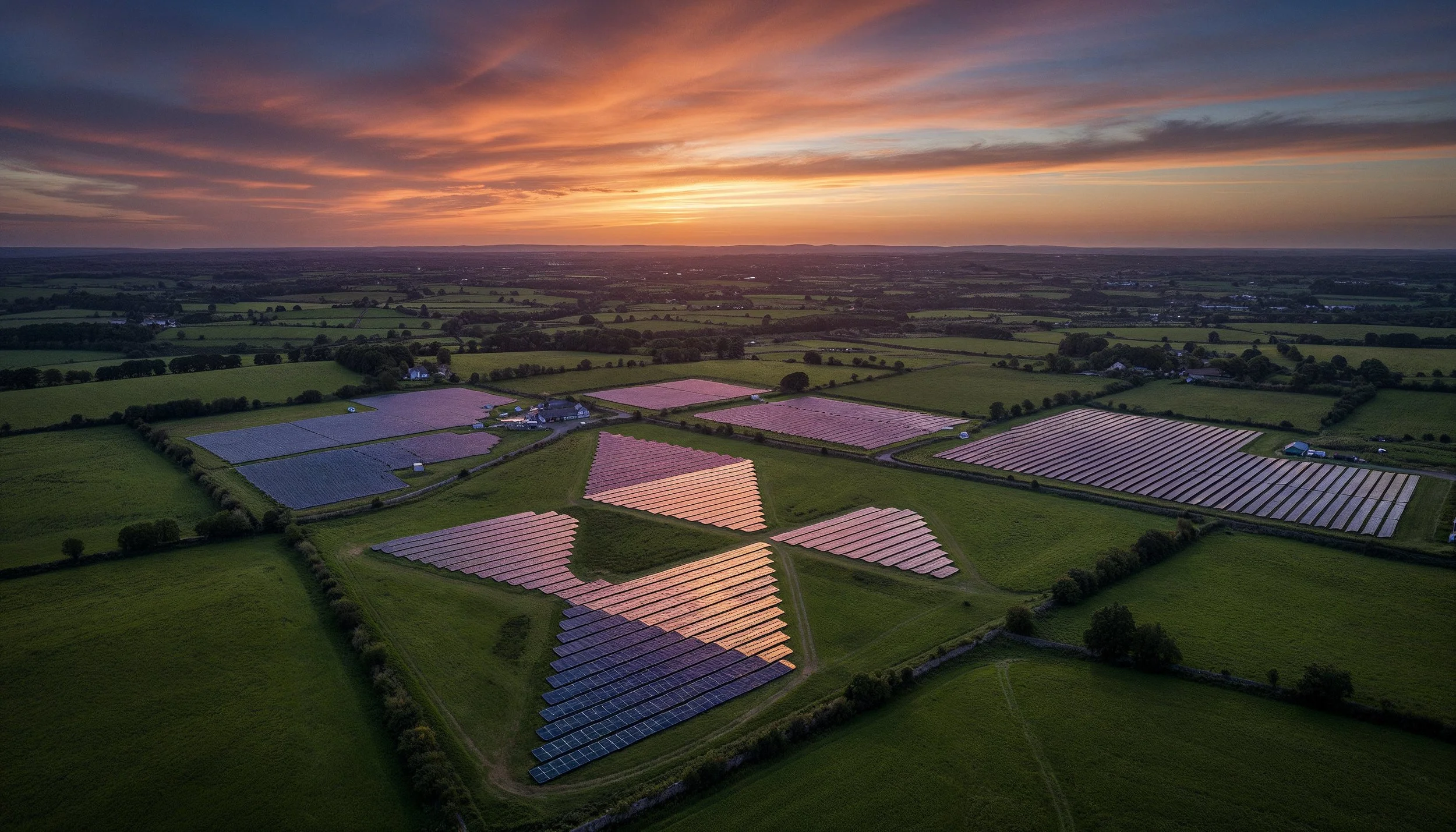
We deliver close-up inspections of bridges, roads, railways, and energy assets. Our high-resolution imagery and video help identify maintenance needs early, improve safety planning, and reduce downtime across critical infrastructure networks.
Progress Tracking & Compliance Reporting
Document construction phases with consistent aerial monitoring. Our services provide visual evidence of progress, support compliance reporting, and help project managers communicate clearly with contractors, stakeholders, and investors.
Marketing & Public Relations Support
Highlight major infrastructure investments with stunning promotional imagery. Our aerial photography and video showcase the scale and impact of projects, ideal for press releases, investor presentations, and community engagement.

CASE STUDY
AIB, Greenlink
Greenlink
As a trusted partner, we align our expertise with your organizational goals, delivering tailored solutions that drive measurable outcomes and long-term success.


From Vision to Reality
Working with Aerial is a seamless and professional experience from start to finish. We handle everything from planning and compliance to data capture and final delivery, ensuring a hassle-free process for our clients. Our team prioritizes efficiency, accuracy, and safety, so you get high-quality results without disrupting your operations. Below is a step-by-step breakdown of what you can expect when partnering with us.

We begin with a discussion to understand your project’s needs, scope, and objectives. A precise flight plan is designed to capture the required data efficiently. We coordinate with your team to schedule flights at the best times for minimal disruption.
1. Consultation & Planning

2. Aerial Capture
Using advanced drone technology, we capture high-resolution imagery, videos, or survey data. Our experienced pilots ensure accuracy and safety while keeping operations quick and efficient.

3. Post Processing
Collected data is processed using industry-leading software to generate maps, reports, and marketing visuals. We refine and format the outputs to ensure they’re clear, actionable, and ready for use.

4. Delivery
Final assets are delivered in your preferred format, with explanations or insights as needed. We remain available for any follow-up questions, future updates, or additional services.


Sean Noone - Platt Reilly
"Partnering with Aerial was a great experience. They were extremely helpful, providing creative ideas and working closely with us to produce a high-quality product. Their professionalism and efficiency made the entire process seamless and stress-free. Highly recommend." -

Full Production Service
At Aerial, we provide a seamless, end-to-end production service, ensuring every project is expertly managed from concept to final delivery. Our team handles everything from planning and coordination to on-the-ground videography and dynamic aerial drone filming, capturing stunning visuals with precision and creativity.

Project Management

Videography

Film Crew

Drone Filming

Post Production
SERVICES
We can complete custom drone shoots, or provide stock aerial footage for use in a variety of projects.

Cinematic Aerial Footage at Your Fingertips
Stock Library
Safety First
A SORA license, issued by the European Union Aviation Safety Agency (EASA), is a safety approval for drone operations that don’t fit into the standard low-risk rules. It’s used for activities that might involve more complicated or higher-risk situations, like flying drones over people or in busy areas.
We also hold a license for the UK
The SORA license allows us to operate in areas and to limits that other drone operators can’t access.

1KM
HEIGHT
CITY CENTRE


DISTANCE
AIRPORTS

400FT
FAST PERMISSIONS
LARGE CROWDS


Request Our Brochure
