

EVENTS
Capturing Moments. Retelling Stories.
Complete Service Provider
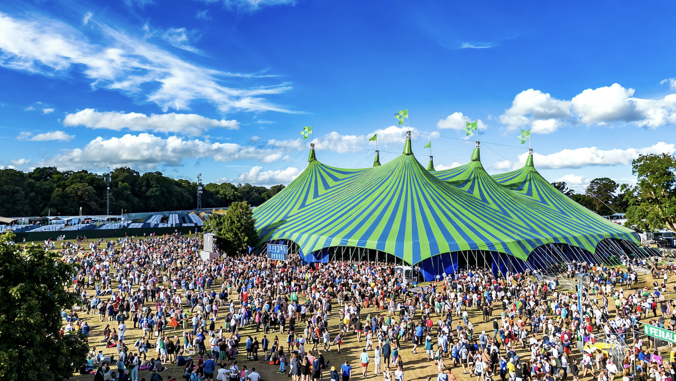
Capture your event from spectacular new angles with Aerial’s professional drone services.
From major festivals to private corporate gatherings, our experienced team delivers cinematic, safe aerial coverage that captures every key moment.


We deliver dynamic, creative drone footage that brings events to life. Capture crowd shots, venue overviews, and key highlights that can be used across promotional materials, social media, and press coverage.
Cinematic Event Filming
Live Streaming & Real-Time Broadcasts
Our team supports live streaming aerial footage for festivals, sporting events, and product launches. Real-time coverage enhances audience engagement, broadens reach, and creates memorable experiences for viewers.
Post-Event Highlights & Marketing
Turn your event into a long-lasting marketing asset. We produce aerial highlight reels and promotional videos that help you celebrate success, attract future attendees, and maximise the value of your event.

CASE STUDY
Davis Events / Cork City County Council
Cork City Marathon
Ireland’s second largest marathon, winding through the heart of Cork City.


“
Davis Events Agency - Ben Rowe
"Aerial.ie has been our trusted supplier for many years. For their professionalism, expert guidance on timelines and licensing, attention to detail on both spectacular end-imagery and with their commitment to safety and compliance they are easy to recommend. Having collaborated on mass participation sporting events as well as historic homecomings and major concerts, they have always been at the top of our list for any drone imagery requirements.”

Live Music Events
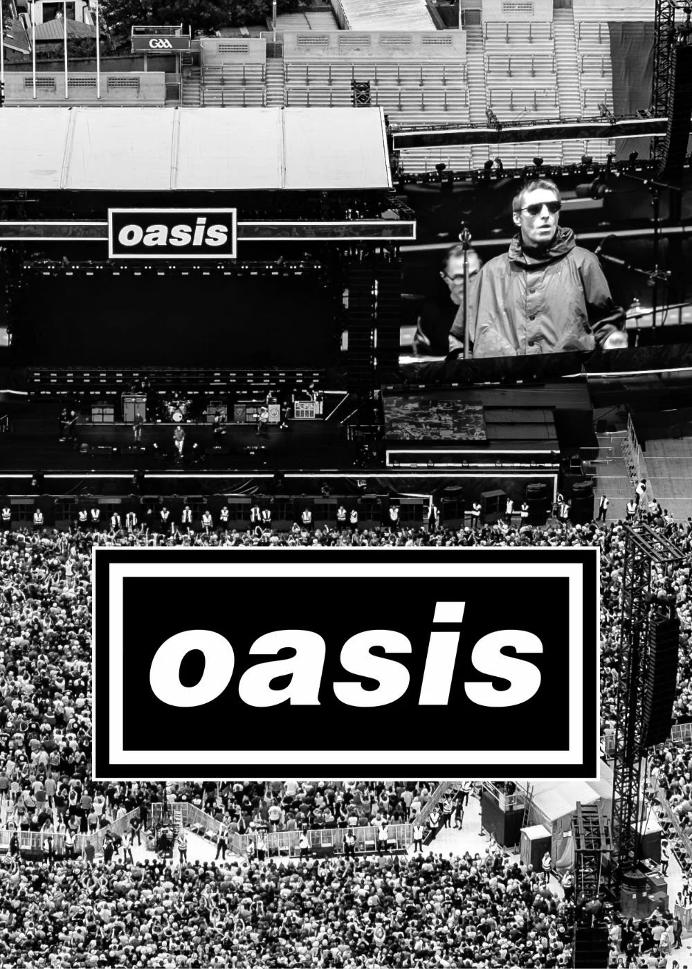
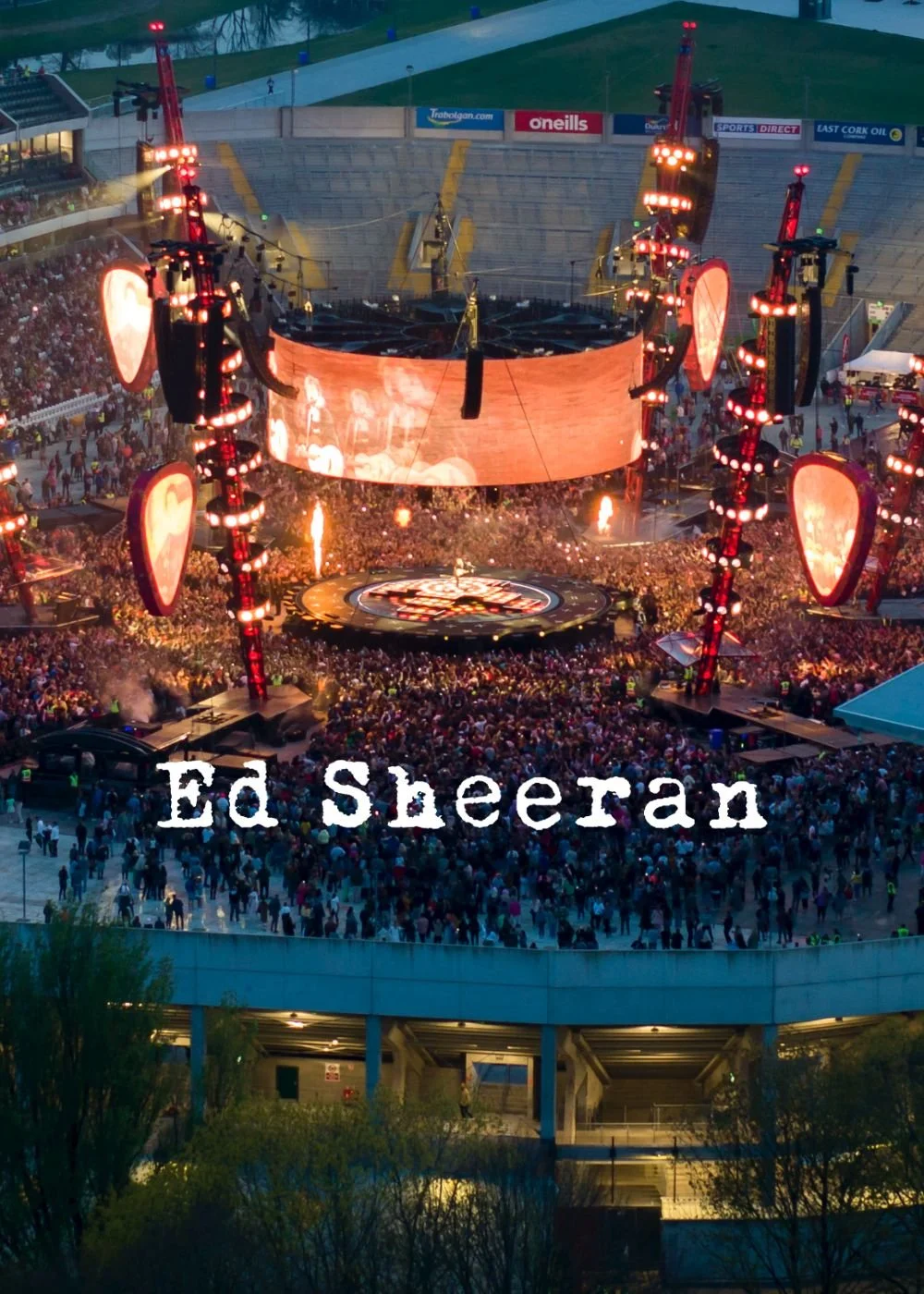
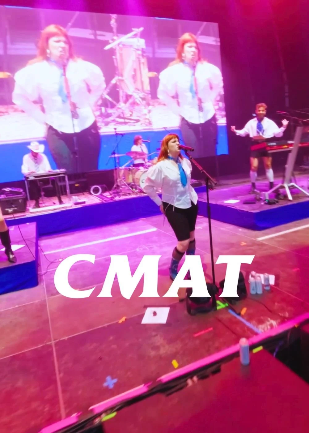
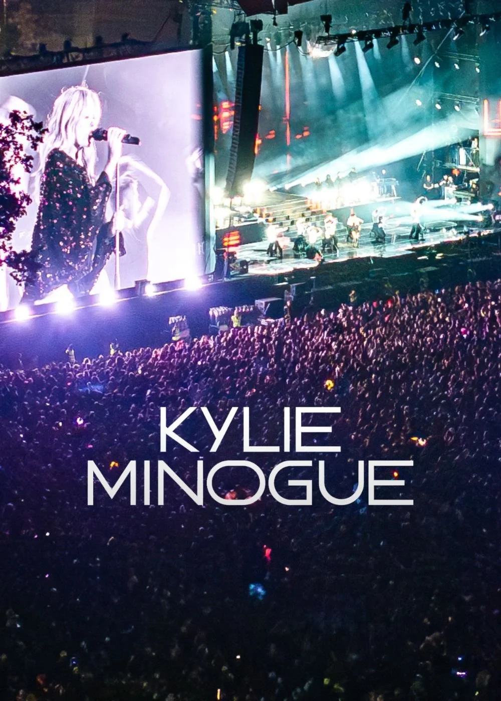
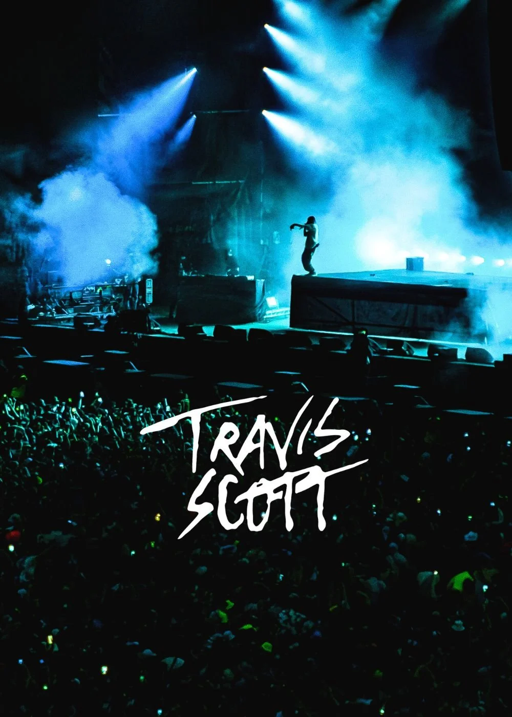
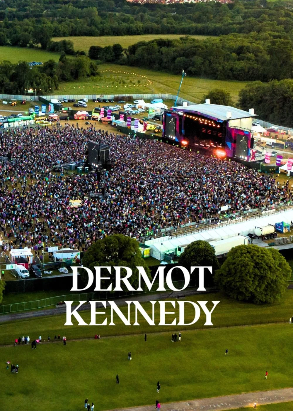
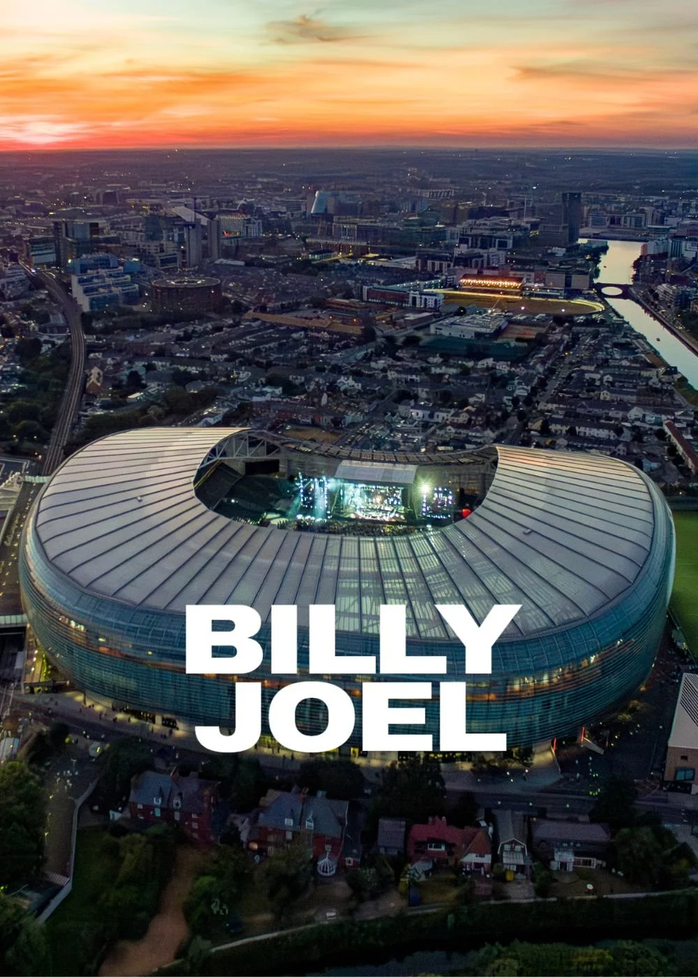
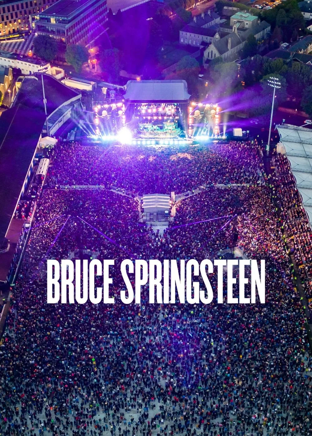
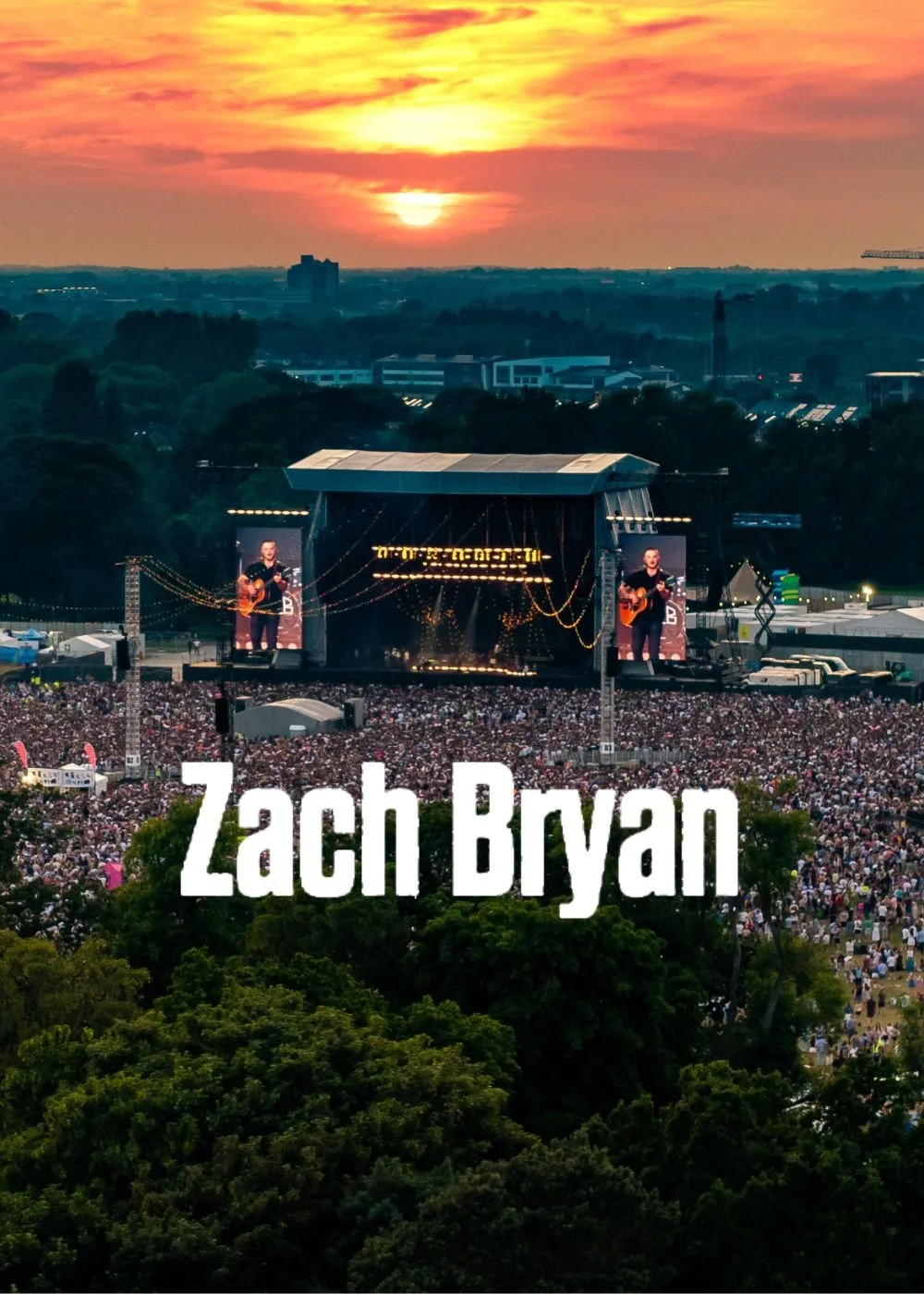
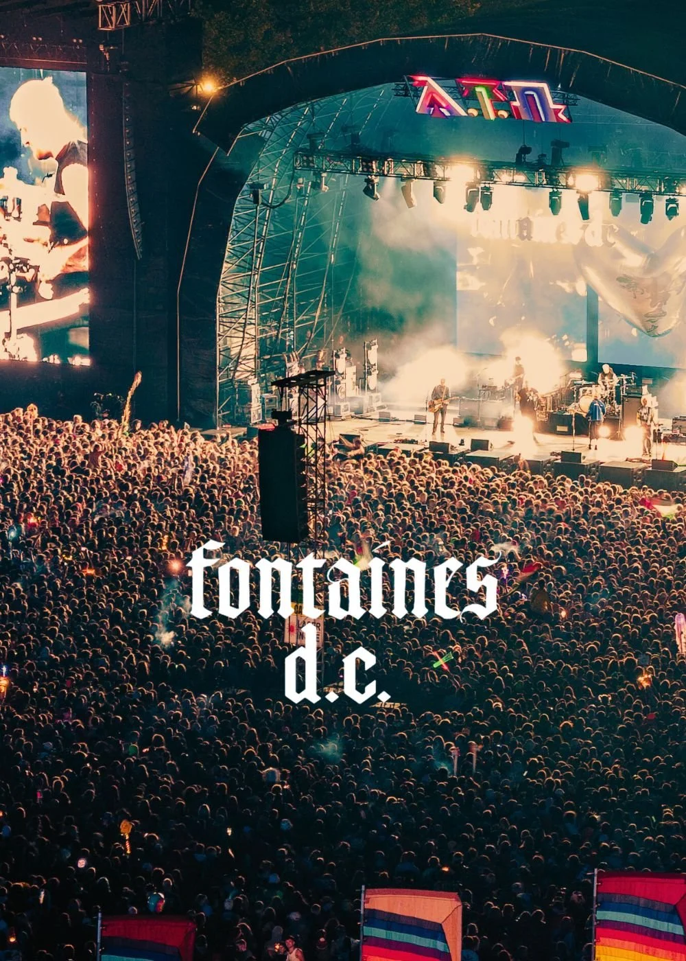
At Aerial, we bring years of expertise to the art of aerial filming at live music events. Since 2015, our team has captured concerts and festivals across Ireland and beyond, working seamlessly alongside event producers, stage managers, and broadcast teams. We understand the unique demands of filming in high-energy, dynamic environments, and we know how to anticipate the rhythm of a performance. This experience allows us to deliver cinematic shots that enhance the atmosphere without ever interrupting the flow of the event.
Experience
Safety is at the heart of everything we do. Our pilots are fully licensed and insured, and we operate under strict compliance with aviation regulations. From pre-event site surveys to real-time risk assessments, we ensure every flight is carefully planned and executed. Whether flying over packed audiences or around elaborate stage setups, we use the latest drone technology and safety protocols to guarantee reliability and precision. For event organizers, this means peace of mind, knowing that our operations meet the highest professional standards.
Safety
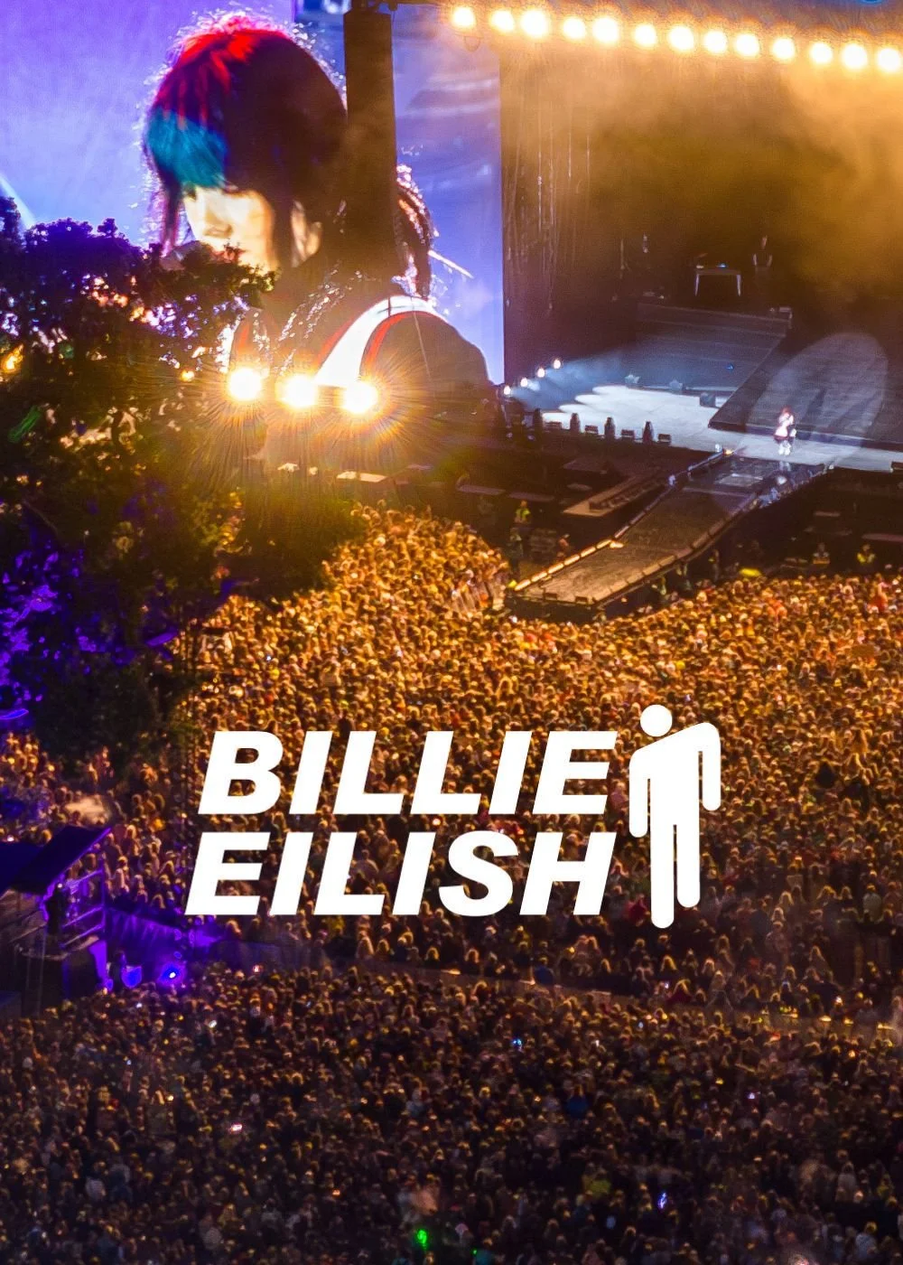
What sets Aerial apart is our creative approach to storytelling from the skies. We don’t just capture footage; we create unforgettable perspectives that bring the energy of a live concert to life. Using FPV drones for immersive crowd sweeps, smooth cinematic tracking shots, and dynamic aerial angles, we translate the excitement of the moment into visuals that stand out. Every project is tailored to the event’s style, ensuring that the final film reflects the unique atmosphere of the performance. With Aerial, creativity takes flight.
Creativity

Full Production Service
At Aerial, we provide a seamless, end-to-end production service, ensuring every project is expertly managed from concept to final delivery. Our team handles everything from planning and coordination to on-the-ground videography and dynamic aerial drone filming, capturing stunning visuals with precision and creativity.

Project Management

Videography

Film Crew

Drone Filming

Post Production
From Vision to Reality
Working with Aerial is a seamless and professional experience from start to finish. We handle everything from planning and compliance to data capture and final delivery, ensuring a hassle-free process for our clients. Our team prioritizes efficiency, accuracy, and safety, so you get high-quality results without disrupting your operations. Below is a step-by-step breakdown of what you can expect when partnering with us.

We begin with a discussion to understand your project’s needs, scope, and objectives. A precise flight plan is designed to capture the required data efficiently. We coordinate with your team to schedule flights at the best times for minimal disruption.
1. Consultation & Planning

2. Aerial Capture
Using advanced drone technology, we capture high-resolution imagery, videos, or survey data. Our experienced pilots ensure accuracy and safety while keeping operations quick and efficient.

3. Post Processing
Collected data is processed using industry-leading software to generate maps, reports, and marketing visuals. We refine and format the outputs to ensure they’re clear, actionable, and ready for use.

4. Delivery
Final assets are delivered in your preferred format, with explanations or insights as needed. We remain available for any follow-up questions, future updates, or additional services.
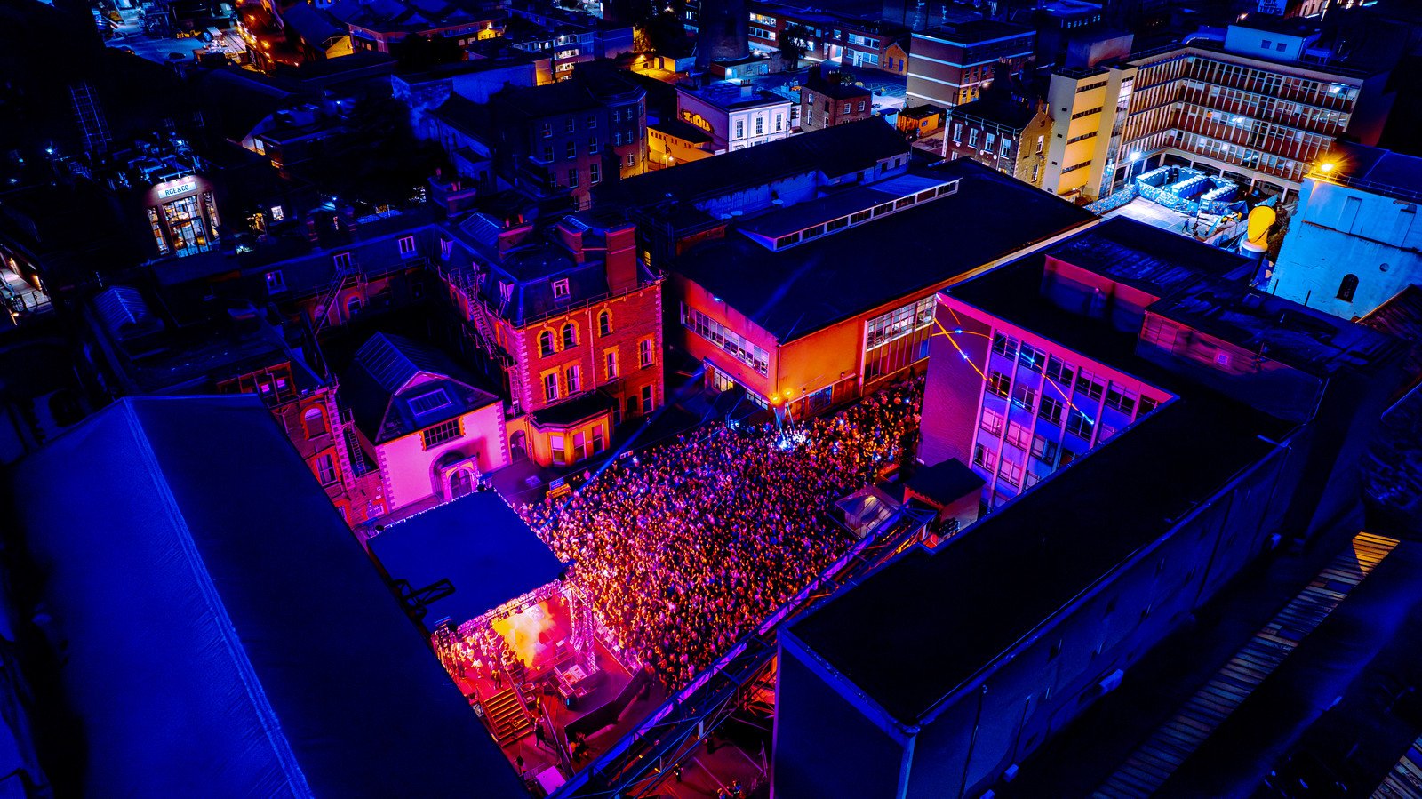

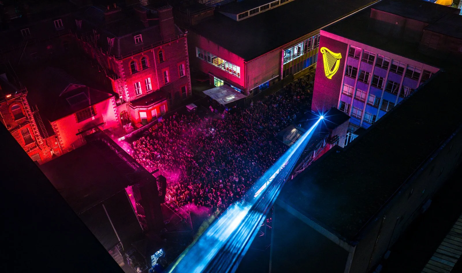
CASE STUDY
Tenth Man / Diageo / Guinness Ireland
Lovely Days Concerts at The Guinness Storehouse
The Lovely Days concerts at Guinness Storehouse / Brewery in Dublin 8.


SERVICES
We can complete custom drone shoots, or provide stock aerial footage for use in a variety of projects.
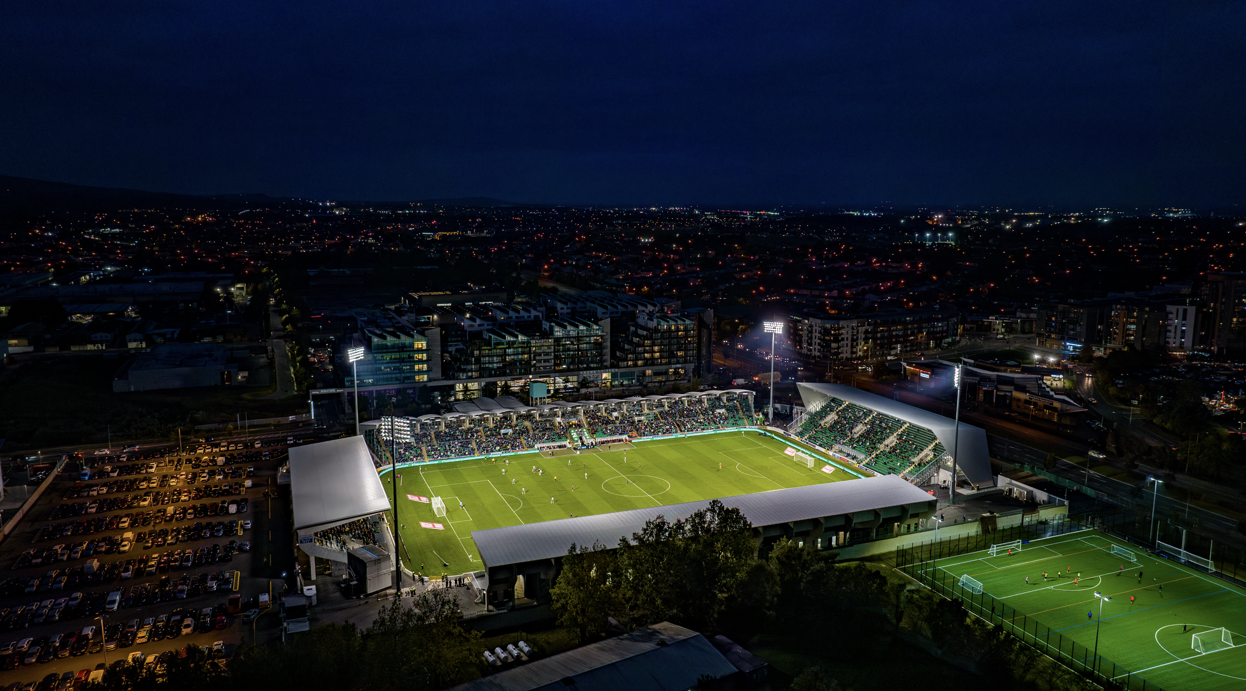
CASE STUDY
Tallaght Stadium

Cinematic Aerial Footage at Your Fingertips
Stock Library
Safety First
A SORA license, issued by the European Union Aviation Safety Agency (EASA), is a safety approval for drone operations that don’t fit into the standard low-risk rules. It’s used for activities that might involve more complicated or higher-risk situations, like flying drones over people or in busy areas.
We also hold a license for the UK
The SORA license allows us to operate in areas and to limits that other drone operators can’t access.

1KM
HEIGHT
CITY CENTRE


DISTANCE
AIRPORTS

400FT
FAST PERMISSIONS
LARGE CROWDS


Request Our Brochure
