


CGI
Visualise It. Create It.
Bring Your Vision To Life
Our CGI drone service combines precise aerial footage with expert post-production to create powerful, photorealistic visualisations. Whether you’re showcasing future developments, planning proposals, or marketing campaigns, we manage the entire process, from capturing cinematic drone shots to delivering fully rendered CGI that helps your audience see what’s possible.

Footage Built For CGI

Stronger Pitches

Fully Managed Service

Cross-Sector Versatility

Photorealistic Results

Single Point of Contact

CASE STUDY
All Together Now Promo
As a trusted partner, we align our expertise with your organizational goals, delivering tailored solutions that drive measurable outcomes and long-term success.
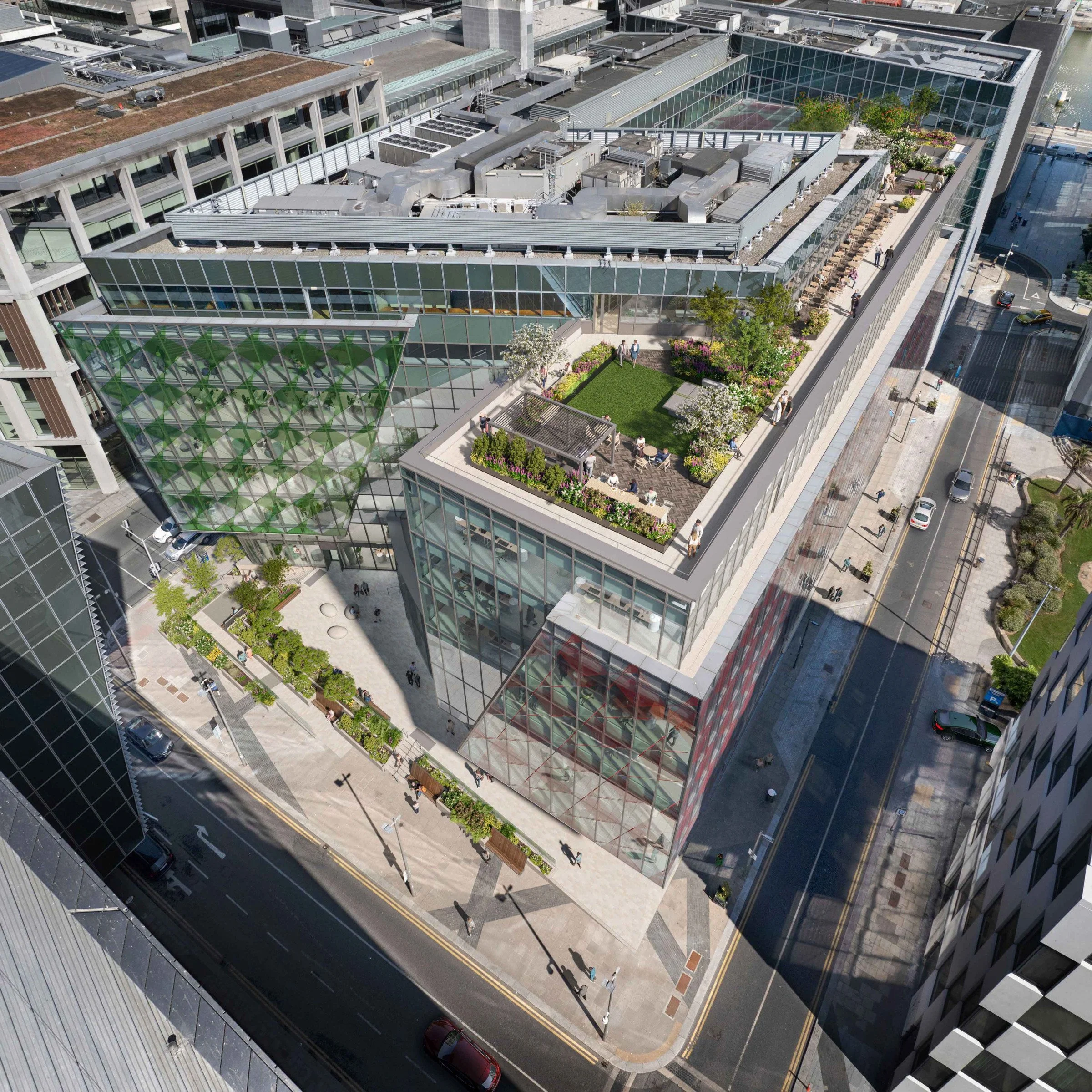
Accurate Aerial Footage for Seamless CGI
We capture high-quality drone footage specifically designed for CGI integration.. stable, well-framed, and optimised for visual effects workflows. Whether for visualisations, planning presentations, or marketing content, our footage provides the perfect foundation for realistic, high-impact CGI work.
End-to-End CGI Project Management
From shoot to screen, we manage the full CGI process so you don’t have to. We work with trusted post-production partners to turn raw aerial footage into stunning rendered environments, architectural models, or animated overlays, all delivered to spec, on time, and with minimal client effort.
Powerful Visualisation for Planning & Marketing
Our CGI services bring unbuilt projects and future plans to life. Ideal for property developers, architects, and infrastructure teams, CGI allows stakeholders to visualise what doesn’t yet exist, helping with approvals, investment decisions, and public engagement through visually compelling content.
Our Process
Working with Aerial is a seamless and professional experience from start to finish. We handle everything from planning and compliance to data capture and final delivery, ensuring a hassle-free process for our clients. Our team prioritizes efficiency, accuracy, and safety, so you get high-quality results without disrupting your operations. Below is a step-by-step breakdown of what you can expect when partnering with us.

We begin with a discussion to understand your project’s needs, scope, and objectives. A precise flight plan is designed to capture the required data efficiently. We coordinate with your team to schedule flights at the best times for minimal disruption.
1. Consultation & Planning

2. Aerial Capture
Using advanced drone technology, we capture high-resolution imagery, videos, or survey data. Our experienced pilots ensure accuracy and safety while keeping operations quick and efficient.

3. Post Processing
Collected data is processed using industry-leading software to generate maps, reports, and marketing visuals. We refine and format the outputs to ensure they’re clear, actionable, and ready for use.

4. Delivery
Final assets are delivered in your preferred format, with explanations or insights as needed. We remain available for any follow-up questions, future updates, or additional services.

CASE STUDY
Shore Club Development
As a trusted partner, we align our expertise with your organizational goals, delivering tailored solutions that drive measurable outcomes and long-term success.

Full Production Service
At Aerial, we provide a seamless, end-to-end production service, ensuring every project is expertly managed from concept to final delivery. Our team handles everything from planning and coordination to on-the-ground videography and dynamic aerial drone filming, capturing stunning visuals with precision and creativity.

Project Management

Videography

Film Crew

Drone Filming

Post Production
Safety First
A SORA license, issued by the European Union Aviation Safety Agency (EASA), is a safety approval for drone operations that don’t fit into the standard low-risk rules. It’s used for activities that might involve more complicated or higher-risk situations, like flying drones over people or in busy areas.
We also hold a license for the UK
The SORA license allows us to operate in areas and to limits that other drone operators can’t access.

1KM
HEIGHT
CITY CENTRE


DISTANCE
AIRPORTS

400FT
FAST PERMISSIONS
LARGE CROWDS


Request Our Brochure
