

SURVEYING
Mapping With Precision. Building With Confidence.
PRECISION DATA
At Aerial, we provide high-precision aerial surveying for faster, safer, and more accurate data collection. Our advanced drone technology delivers detailed site insights, improving planning, monitoring, and compliance while reducing costs and risks.

2D PHOTOGRAMMETRY

3D MAPPING

THERMAL SCANNING

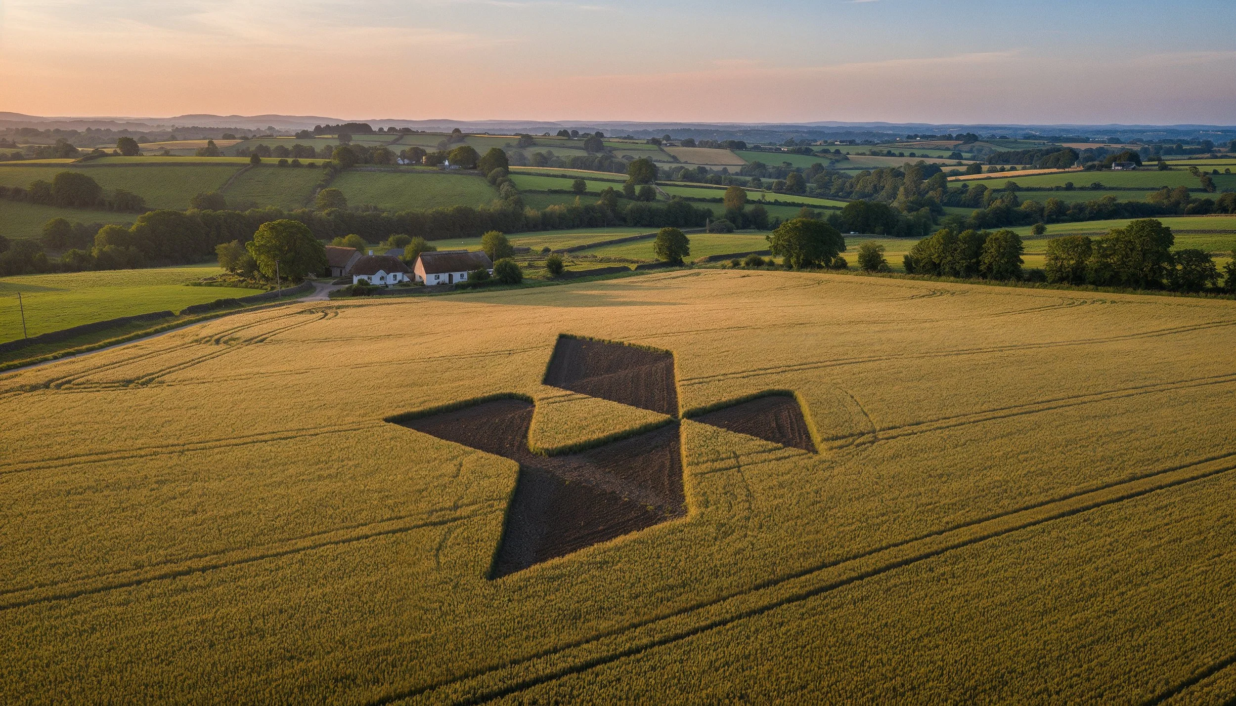
AGRICULTURE INSPECTIONS

LIDAR SURVEYS

SATELLITE IMAGERY
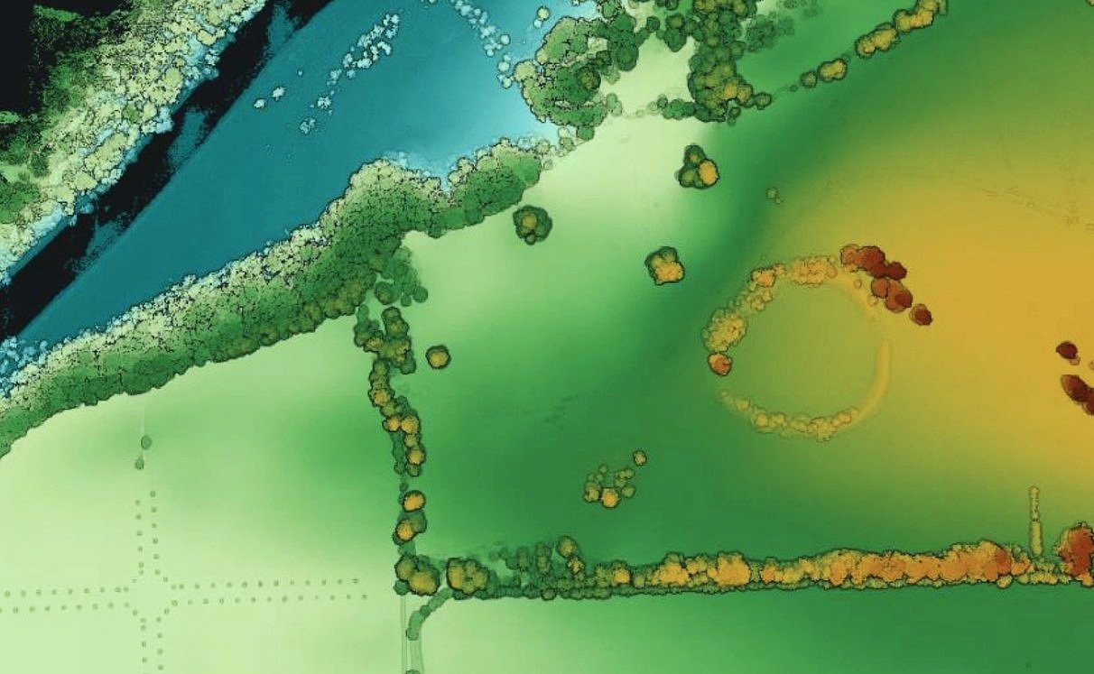
CASE STUDY
Dowth Hall & Grounds
As a trusted partner, we align our expertise with your organizational goals, delivering tailored solutions that drive measurable outcomes and long-term success.
Why Use Drone Surveys
Traditional surveys have long been the standard, but drone surveys offer a faster, safer, and more cost-effective alternative. The table highlights the key differences, showing why drones are the superior choice for modern surveying.
| Factor | Traditional Surveys | Drone Surveys |
|---|---|---|
| Speed | Can take days or even weeks, requiring extensive setup and manpower. | Surveys can be completed in hours, even for large areas. |
| Cost | High costs due to labor, equipment rental, and logistics. | Lower operational costs, requiring fewer personnel and resources. |
| Safety | Surveyors may need to access hazardous terrain, roads, or elevated structures. | No need for workers to enter dangerous areas, reducing risk. |
| Accuracy | Prone to human error and may require multiple site visits. | High-precision GPS & LiDAR ensure more accurate data. |
| Environmental Impact | Can disturb landscapes, wildlife, and require heavy equipment. | Minimal impact—no ground disturbance, lower carbon footprint. |


Pro Enterprise Equipment
At Aerial, we use top-tier professional drones equipped with high-resolution cameras, LiDAR, RTK GPS, and thermal imaging to deliver precise, efficient, and safe surveys. Our industry-leading UAVs capture detailed topographic data, volumetric measurements, and infrastructure assessments with unmatched accuracy and speed, ensuring cost-effective, high-quality results for every project.
Our Process
Working with Aerial is a seamless and professional experience from start to finish. We handle everything from planning and compliance to data capture and final delivery, ensuring a hassle-free process for our clients. Our team prioritizes efficiency, accuracy, and safety, so you get high-quality results without disrupting your operations. Below is a step-by-step breakdown of what you can expect when partnering with us.

We begin with a discussion to understand your project’s needs, scope, and objectives. A precise flight plan is designed to capture the required data efficiently. We coordinate with your team to schedule flights at the best times for minimal disruption.
1. Consultation & Planning

2. Aerial Capture
Using advanced drone technology, we capture high-resolution imagery, videos, or survey data. Our experienced pilots ensure accuracy and safety while keeping operations quick and efficient.

3. Post Processing
Collected data is processed using industry-leading software to generate maps, reports, and marketing visuals. We refine and format the outputs to ensure they’re clear, actionable, and ready for use.

4. Delivery
Final assets are delivered in your preferred format, with explanations or insights as needed. We remain available for any follow-up questions, future updates, or additional services.
SERVICES
We can complete custom drone shoots, or provide stock aerial footage for use in a variety of projects.


Safety First
A SORA license, issued by the European Union Aviation Safety Agency (EASA), is a safety approval for drone operations that don’t fit into the standard low-risk rules. It’s used for activities that might involve more complicated or higher-risk situations, like flying drones over people or in busy areas.
We also hold a license for the UK
The SORA license allows us to operate in areas and to limits that other drone operators can’t access.

1KM
HEIGHT
CITY CENTRE


DISTANCE
AIRPORTS

400FT
FAST PERMISSIONS
LARGE CROWDS


Request Our Brochure
